Oct
1
2025
Listing Status FAQs
Listing Input
Q: When must new listings be entered into the MLS?
- Publicly marketed: within 1 business day
- Not publicly marketed: within 4 calendar days of the listing contract’s effective date
Delayed / No Showings
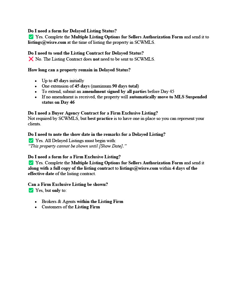
Q: What is Delayed status?
- Listing entered in MLS but not available to show
- Requires the show date in first line of public remarks and in the top portion of your MLS data sheet
- Multiple Listing Options for Sellers form emailed to: listings@wisre.com
- Max: 45 days, with one extension (90 days total)
- No showings allowed (not even to seller or firm)
Withdrawn / Expired / Sold
Q: What does each of the above Listing Status’ mean?
- Withdrawn: No showings or marketing. Reactivate only with a new contract/amendment.
- Expired: If a seller and listing agent agree to end the contract before expiration, update status to Expired.
- Sold: Report within 10 days of closing